IMD Forecasts Heavy Rain For Thane As Region Braces For Intense Monsoon
The India Meteorological Department (IMD) has forecast heavy to very heavy rainfall for Thane and neighbouring Raigad district as intense monsoon activity triggered widespread waterlogging and traffic disruptions across the region on Monday.
The regional weather bulletin warned of continued heavy downpours across the Konkan region. While Thane and Raigad are expected to receive heavy to very heavy showers, neighbouring Palghar was warned of extremely heavy rainfall at isolated places on June 29.
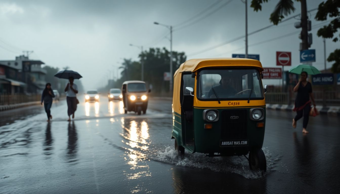
In nearby Mumbai, continuous overnight showers on Monday morning caused waterlogging in several low-lying areas, resulting in traffic snarls and slow vehicular movement. The weather department has placed the financial capital under an orange alert for June 29, as well as from July 1 through July 3.
According to the latest forecast issued by the IMD’s Regional Meteorological Centre, the region is expected to witness heavy to very heavy rainfall accompanied by thunderstorms, lightning, and gusty winds reaching speeds of 30 to 40 kmph at isolated places.
The heavy overnight rain impacted several areas, including Marine Lines, Prabhadevi, Byculla, Lalbaug, Andheri, Malad, Jogeshwari, Kurla, Mulund, and Kanjurmarg. The accumulation of water forced authorities to temporarily close subways in Andheri and Malad during the night.
The Mumbai Traffic Police later confirmed that traffic movement resumed through the subways after the water levels receded by morning. However, wet road conditions along the Mumbai Coastal Road and the Western suburbs contributed to slow-moving traffic during peak office hours. Visuals from Marine Drive also showed strong waves crashing onto the promenade amid the persistent rainfall.
With the weather department warning residents to remain cautious, civic authorities and disaster management teams across the region remain on alert to handle potential waterlogging incidents in vulnerable areas as monsoon activity continues to intensify.